2010 - Humanitarian Mapping in Haiti
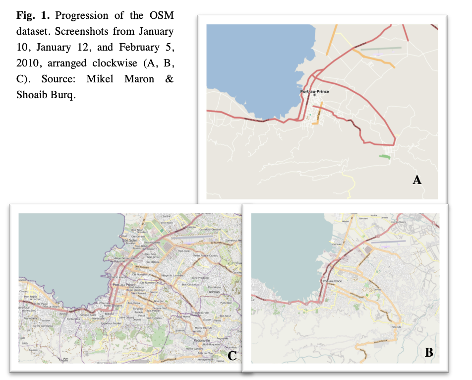
In January 2010, Haiti experienced a devastating earthquake: one of the worst disasters in recent history. Within 48 hours of the earthquake, the OpenStreetMap community started using high-resolution, post-event satellite imagery to map the area impacted by the earthquake, and it would forever change crisis mapping.
Within weeks, over 600 contributors volunteered their time and skills to build a base map of Haiti on OpenStreetMap. It would become the default map for organizations responding to the crisis, including urban search and rescue teams and NGO partners. (source) OSM received major media coverage for its humanitarian role in this crisis, including in Wired magazine, the New Yorker, the Guardian, and many others.